Results
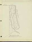
- Map derived from a survey made in 1840 by William Milburn of St. Louis, Mo. Map is in the Engineering Dept. Evanston City Hall.Map derived from a survey made in 1840 by William Milburn of …
- Three small maps showing changes in Wilmette from 1804-1852.Three small maps showing changes in Wilmette from 1804-1852.
- Map showing geological formation of Wilmette from glacial moraines remaining after the Great Ice AgeMap showing geological formation of Wilmette from glacial moraines remaining after the …
- Map adapted from original survey in 1818 and a resurvey, 1837-1839Map adapted from original survey in 1818 and a resurvey, 1837-1839
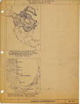
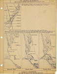
- How "Lake Chicago" was filled in to form the shore line of Lake MIchigan. Shows the several stages wherein, due to the prevailing North East South West lake current, the spoil from the wave action onHow "Lake Chicago" was filled in to form the shore line of …
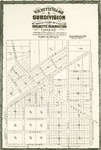
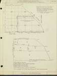
- Also the 40 feet N. of and adjoining the centre of North Ave. and the 33 feet S. of and adjoining the center of Soutn Ave. as shown by this plat.Also the 40 feet N. of and adjoining the centre of North …
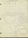
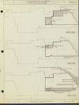
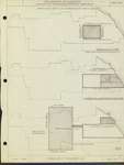
- Small maps showing area in 1883-1911 including 1883-1886 ; 1889-1890; 1906-1911.Small maps showing area in 1883-1911 including 1883-1886 ; 1889-1890; 1906-1911.
- Map covers development from 1869-1874. Shows original plat of survey 1869; Wilmette as incorporated, Sept. 19, 1872; and Wilson's addition and Gross Point 1874.Map covers development from 1869-1874. Shows original plat of survey 1869; Wilmette …
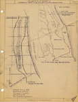
- Map shows developments from 1829-1842. The fourth article of the Treaty of Prarie du Chien, 29th of July, 1829 granted to Archange Ouilmette, a Potawatamie woman, wife of Antoine Ouilmette, for herseMap shows developments from 1829-1842. The fourth article of the Treaty of …
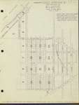
- Map of Wilmette in the 1870s. The map shows east and west alleys south of North Avenue. The original plan had north and south alleys.Map of Wilmette in the 1870s. The map shows east and west …
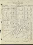
- Early street map of Wilmette from Division St. (aka 8th St.) to West (aka Park) showing former street names. Adaptation of engraving by Louis Helke & Co.Early street map of Wilmette from Division St. (aka 8th St.) to …
- Map showing shoreline and locations of early landmarks. Mark includes image of Winnetka Historical Society seal.Map showing shoreline and locations of early landmarks. Mark includes image of …
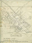
- No Man's Land annexed to Wilmette, Illinois, in 1942.No Man's Land annexed to Wilmette, Illinois, in 1942.
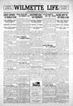
- Wilmette Life (Wilmette, Illinois), 26 Oct 1995, p. 175 ...Wilmette Life (Wilmette, Illinois), 26 Oct 1995, p. 175 ...
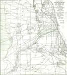
- Lake Shore News (Wilmette, Illinois), 26 Dec 1912, p. 7 The director of the geological survey has announced a price increase for topographic maps of the United States after January 1.Lake Shore News (Wilmette, Illinois), 26 Dec 1912, p. 7 The director of the geological survey has announced a price increase for …
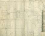
- Three maps taped together showing Gross Point and Wilmette. Scanned image shows only portion containing Gross Point, Illinois. Map shows some former street names.Three maps taped together showing Gross Point and Wilmette. Scanned image shows …
- Trails (1804) as shown by weapons and implements of the stone age. Printed on heavy, cream paper.Trails (1804) as shown by weapons and implements of the stone age. …
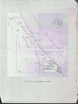
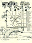
- Pictorial map of Wilmette, Illinois, historical sites in blue and shades of rose.Pictorial map of Wilmette, Illinois, historical sites in blue and shades of …
- Wilmette Historical Commission, Wilmette Life (Wilmette, Illinois), 18 Sep 1952, Front Filed in Vertical File "Anniversary - Charter Day"Wilmette Historical Commission, Wilmette Life (Wilmette, Illinois), 18 Sep 1952, Front Filed in Vertical File "Anniversary - Charter Day"


