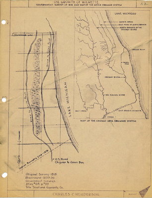
Original Survey 1818
Resurveyed 1837-39
Government Surveys Atlas #65, p.39
Title Trust and Guaranty Co.
Map shows U.S. Road from Chicago to Green Bay, Indian Boundary Line 1876, Lake Michigan, Road to Gross Point
Map of the Chicago Area Drainiage system shows Skokie Creek; East Fork of the North Branch; North Branch of the Chicago River; Grosse Point; Canal 1906; Chicago River; Des Plaines River, Salt Creek ; South Branch of the Chicago River


