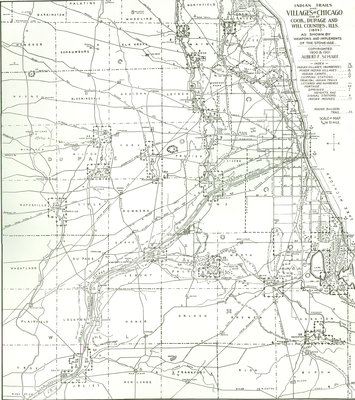
Map Indian Trails and Village of Chicago and of Cook, Dupage and Will Counties, Illinois
Description
- Creator
- Albert F. Scharf, Cartographer
- Media Type
- Image
- Text
- Item Type
- Maps
- Description
- Trails (1804) as shown by weapons and implements of the stone age. Printed on heavy, cream paper.
- Inscriptions
- Index: Indian villages (numbered), minor camps, chipping stations, principal indian trails lettered and numbered, portage, springs, heights and signal stations, indian mounds, mound builders trail
- Date of Publication
- 1900
- Dimensions
-
Width: 13 in
Height: 17 in
- Map Scale
- 5/16 inch to mile
- Subject(s)
- Local identifier
- Map 18
- Language of Item
- English
- Geographic Coverage
-
-
Illinois, United States
Latitude: 42.07225 Longitude: -87.72284
-
- Copyright Statement
- Public domain: Copyright has expired according to United States law. No restrictions on use.
- Copyright Holder
- Wilmette Public Library
- Terms of Use
- Digital image may be used with credit to Wilmette Public Library
- Contact
- Wilmette Public LibraryEmail:refdesk@wilmettelibrary.info
Website:
Agency street/mail address:1242 Wilmette Avenue
Wilmette, IL
60091-2558
U.S.A. Phone: 847-256-6930


